Kraken autonomy stack
An autonomy stack for an Ackermann orchard robot, and the harness that measures it. Three questions, one robot.
Does it still know where it is when the sensors lie to you? Break the sensors mid-drive, score the estimate against ground truth, and keep the failing configuration as the control case.
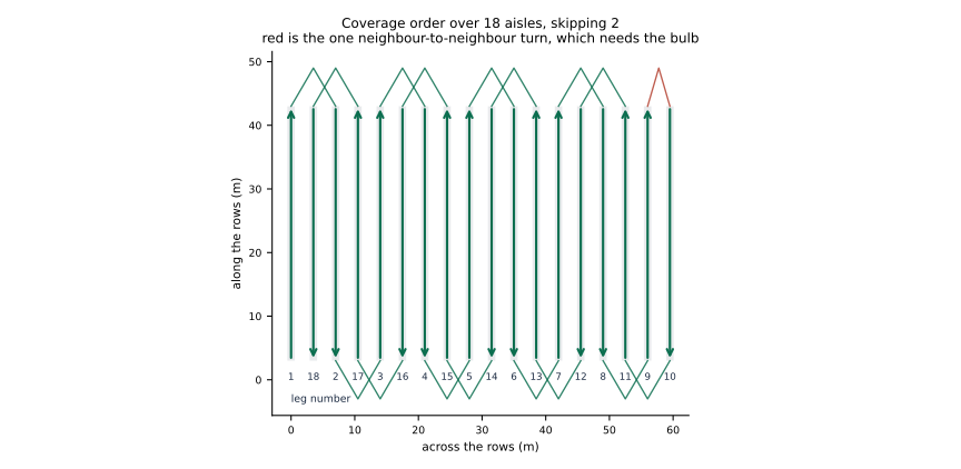
Can it do a day’s work without being told where to point? Eighteen aisles, 3.5 m apart: drive every one of them and come back. It plans its own headland turns on geometry, follows them on curvature, and never leaves the boundary it was given.
Does it stop for a person standing in the row? The ISO 18497 test object on the centreline, at full speed, seven runs: it stops 0.78 m short every time. The same suite proves it does not stop for the trees, because a machine that stops for everything has not solved anything.
Start here → — nothing to install but Docker, and the whole suite runs in under ten minutes.
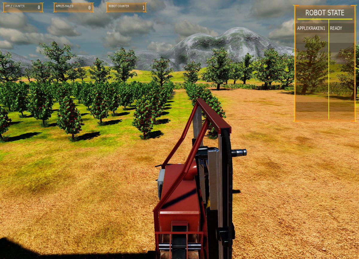 The machine at the edge of the field in O3DE, aisles running away to the left.
The subsystems
| Page | What it owns |
|---|---|
| Simulation environment | The headless kinematic model that owns /clock, the O3DE scene, and which one is real about what |
| Localisation | EKF profiles, what is fused and why, the fault shim, the robustness suite and how a run is scored |
| Row perception | Turning a lidar cloud into the corridor the machine is standing in |
| Navigation | Field layout, the skip rule, headland turn geometry, refusing a turn that will not sweep, the geofence |
| Control | Reading arcs out of a path, the curvature trim law, speed limits, refusing to drive |
| Mission planning | The CoverRows action, the navigator plugin, the behaviour tree, why the machine never stops between rows |
And four references that cut across all of them:
- Getting started — prerequisites, the suite, a single scenario, the coverage run, the tests.
- Safety — the two protective layers, the ISO 18497 test object, what the headless suite gates and what only the simulator can show.
- Fault modes — what each injected fault does to which channel, and how to add one.
- Design notes — why the shim sits outside the simulator, why there is a headless model at all, why terrain is the exception, why the goal error is scored twice, and the known gaps.
How it fits together
flowchart LR
    world["simulation<br/>O3DE or headless"]
    inj[fault_injector]
    ekf["localisation<br/>navsat_transform + EKF"]
    percep["row perception"]
    mission["mission planning<br/>CoverRows navigator"]
    planner["navigation<br/>Smac + headland planner"]
    ctrl["control<br/>ArcTracker"]
    scorer[(scorer)]

    world -->|GNSS, IMU, wheels, radar| inj
    inj --> ekf
    world -->|lidar cloud| percep
    ekf -->|odometry/filtered| planner
    ekf --> ctrl
    percep -->|centreline| ctrl
    mission --> planner
    planner -->|path| ctrl
    ctrl -->|cmd_vel| world
    ekf --> scorer
    world -->|ground truth| scorer
The arrow that matters is the one that is missing: nothing feeds ground truth back into the robot. Nav2 judges arrival from the filter’s estimate, because the estimate is all it has, which is why a biased estimate moves the finish line with it and cancels out of every number the robot can check about itself. The scorer sits outside the robot for exactly that reason.
The short version
| Field | 18 aisles, 3.5 m pitch, 44 m rows |
| Machine | Ackermann, 2.2 m wheelbase, 0.7 rad lock, 3.1 m long |
| Tightest circle | 2.61 m radius — wider than one aisle, so turns skip |
| Coverage | every aisle, one geometric headland turn between each |
| Best measured | 4/4 aisles, 0.02–0.11 m off the planned path |
| Stops between rows | none — the turn is appended to the path being followed |
| Localisation, GNSS lost | 0.36 ± 0.25 m with the gyro fused, 21.8 ± 0.9 m without |
| Suite | 20 scenarios, headless, no GPU, about ten minutes |
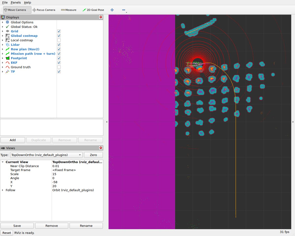 Mid-mission. The machine has turned in off the headland and is running the
aisle; the yellow line is the row and its next turn as one path, the cyan
clusters are lidar returns off the trunks, and the magenta block on the left is
the keepout mask that stops it leaving the field.
Repository layout
docker/                 stack (no GPU), simulation (O3DE, GPU) and viz images, plus the
                        scripts that graft the localisation sensors onto the ROSConDemo Kraken
docs/                   these pages
patches/                patches applied to the O3DE engine and gems at image build time
Project/                O3DE project skeleton
ros2_ws/src/
  kraken_interfaces/    FaultSpec, LocalisationScore, RowEstimate, SetFault, CoverRows
  kraken_sim/           headless kinematic simulator, owns /clock, models terrain traction
  kraken_faults/        the fault injector shim between the sensors and the filter
  kraken_localisation/  EKF profiles (naive / robust / radar) + navsat_transform
                        + safety_monitor, which gates cmd_vel on filter health
  kraken_scenarios/     scenario files, scorer, runner, sweep, launch tests
  kraken_nav/           Nav2 plugins: CoverRowsNavigator, HeadlandPlanner, ArcTracker,
                        BT nodes, nav2.yaml, keepout mask, launch files
  kraken_orchard/       row perception: fits the trunk lines either side from the lidar
                        cloud and publishes the corridor between them
Source: github.com/eborghi10/kraken-demo. BSD-3-Clause.